"A Walk in the Woods, Part 3"
A Third 100 Mile Hike.
May 12-20, 2012
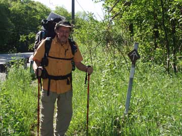
Heading south!!
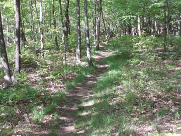
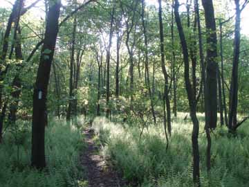
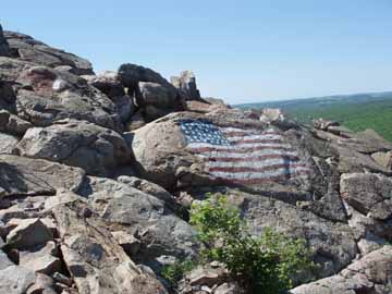
Pretty Trail. Waiting for me? My view for the night.
We left home on Friday, May 11, 2012 and traveled to Denville NJ to spend the night. After a great meal and a good nights sleep we left the hotel Saturday, May 20 for Branchville NJ (26 miles). The weather was clear, but a little cool, upper 60's.
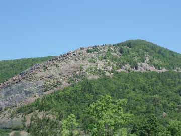
Tina dropped me off at the trailhead at 9:15 am and I began the climb to the top of the mountain. The initial climb was not too bad taking only about 30 minutes. I stopped partway up to remove the leggings from my convertible pants. Once I got to the top the trail leveled off and for the most part followed the crest of the mountain. There were many open areas for great views and it appeared that there were lakes everywhere. My plan was to go 10.6 miles to an abandoned YMCA camp. My guide book mentioned that there were two shelters and water at the camp. Arrived at the road to the camp about 4:00 pm and decided to walk the additional .8 mile to the camp. The camp was deserted and the shelters were not fit to use. One was surrounded by water from the lake and the other was partially surrounded by water. Neither looked safe and there was no drinking water.
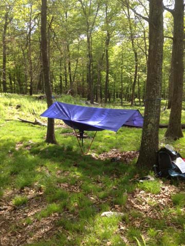
So I retraced and continued on another half mile to some grassy areas open for camping. I arrived at 5:30 pm. On the way to the campsite I passed a water pump that was listed as a water source. It was not working. I picked a level grassy area overlooking Crater Lake and hung my hammock. Had a light supper and turned in for the night. I fell asleep looking down on the lights along the lake. Had two visitors, a porcupine wandered in and climbed a tree very close to where I was hanging, and a deer. Slept well. Hiked 11.1 miles.

A beaver dam. Night 2. Many views like this.
Sunday, May 13, 12.5 miles. Weather was warm and sunny.
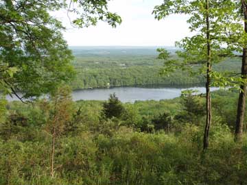
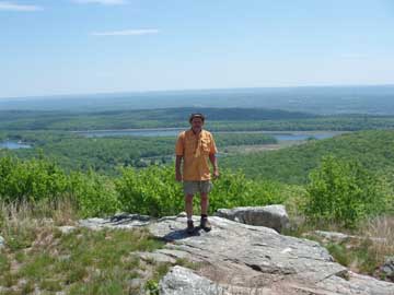
Up at 5:15 am and on the trail before 6:00 am. The trail was still pretty rocky. Stopped at the Mohican Outdoor Center and enjoyed a Coke and some M & Ms. I came upon a beaver dam. You could see the beaver hut far out on the pond. The beavers had built a berm along the lower edge of the pond that allowed the water to actually rise above the trail on the pond side. Continued on south while enjoying the beautiful views along the way. One view was especially nice as you could see for miles on all sides. Came by Sunfish Pond. The trail ran right along the west side of the pond over many large rocks. Saw 3 water snakes, 2 within 10 yards of each other. Arrived at the Backpackers Campground at 2:30 pm. I set up the hammock and prepared to spend the night. A few day hikers were wandering around but by dark I was all alone for the second night in a row. Saw deer pass through the campsite.
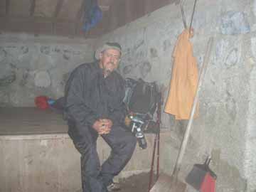
Crossing at the Water Gap The view from the top, PA side. Kirkridge Shelter, Night 3.
Monday, May 14, 11.2 miles. Started out overcast but cleared early and was sunny and warm till about noon. Then started raining.
Awake at 5:30 am and back on the trail at 6:15 am. It rained at some point during the night but I was remained dry. The trail descended on a fairly rocky trail early. The trail became smoother the further down the gap I went. Arrived at I-80 at 8:00 am and made my way in to Delaware Water Gap. Found a mom and pop dinner and enjoyed eggs, bacon, home fries, toast, and orange juice while charging my phone. Left the dinner at 9:30 am and headed south. The trail ran along the mountain and then turned straight up. It took me close to an hour to get to the top (No Climbing Legs). Fortunately the trail became a grassy level road for about 2 miles and then turned back into the woods remaining pretty level until I got to the Kirk Ridge Shelter at 1:30 pm I was amazed!!! I didn't expect to make the shelter till around 3:00. Started with a light rain off and on about 12:30. After I got to the shelter the rain increased, becoming heavy at times and continued through the night and into the next day. Spent the night with Sidewinder (northbounder).
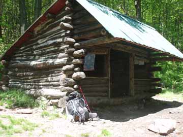
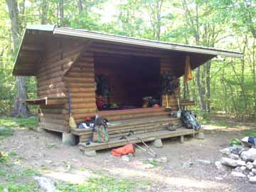
Leroy A Smith Shelter, Night 4.
Tuesday, May 15, 13.8 miles. Rained, hard at times till mid afternoon, then sunny with an evening thundershower.
Woke at 6:00 am with heavy rain and wind. Pondered taking a zero day because of the weather and because of having to cross Wolf's Rocks in the rain. Sidwinder mentioned that he had slipped and fallen on the rocks coming northbound. I wasn't sure if I could complete the section if I lost a day to the rain. The sleeping bag was warm and comfortable. Around 8:00 am the rain slowed so I packed up, called Tina to let her know I was moving on, and headed south toward Wind Gap..
About :30 minutes later the rain became intense. I was totally soaked by the time I reached Wolf's Rocks. I took my time and crossed the rocks with no real problems. The wet fern fields were so green. .The rain continued all the way to Wind Gap, arriving at 12:50 pm. Walked the .50 miles down to the Turkey Hill for a quick lunch and then back up to the Post Office to pickup supplies I had shipped ahead. I was hoping for pizza but the pizza shop next to the Post Office was closed. A nice gentleman stopped and offered me a ride but I refused because I was so wet. At 2:10 pm after picking up supplies I hiked back up to the trail head and began the climb out of Wind Gap. The assent headed south was not too bad and I made pretty good time. I arrived at the Leroy Smith Shelter at 4:30 pm.
There were 4 people at the shelter, me making 5. It was going to be a cozy night. A quick thunderstorm blew through early in the evening. Saw a scarlet tanager, my first.
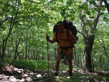
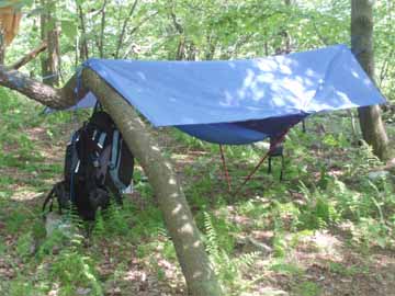
Rocky Trail. Hanging from a tree, Night 5.
Wednesday, May 16, 8.8 miles. Warm and sunny, mid to upper 70's.
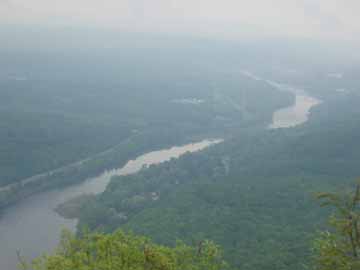
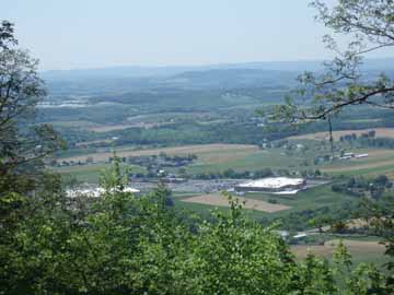
Left the Leroy Smith Shelter at 7:15 am hoping to get to a camp site about .50 miles from Blue Mountain Road (Big Gap). That would let me rest before crossing the Super Fund Site at Palmerton. The trail was fairly easy and I arrived at a camp site overlooking the Lehigh Valley about 1:30 pm. I stopped and setup camp, hanging my hammock, and laying wet cloths, equipment, and shoes out to dry.
Another section hiker came by about 3:00 pm and said I was still about 2 miles from Big Gap. Having already setup I decided this was a good place to stay, I could use the rest for tomorrow and the view was great, especially when the lights came on in the valley below after dark.
Saw another scarlet tanager today. They are a migratory bird that winters in South America and is somewhat common in PA, These are the first two that I have seen. A ground hog came wandering by about dusk.
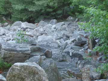
Good Trail Bad Trail Superfund Site, Palmerton.
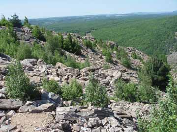
Superfund Site, Palmerton Crossing From the other side of the river.

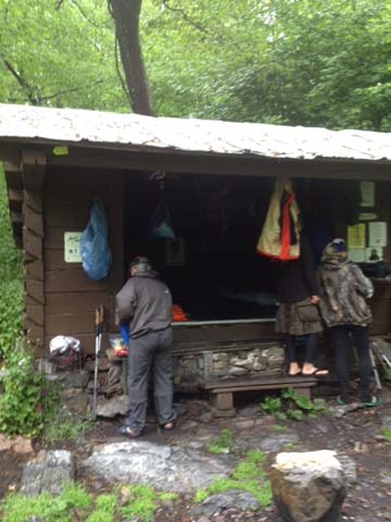
Outerbridge Shelter, The log mentioned snakes. My home, Night 6.
Thursday, May 17th, 8.9 miles. Started out cold, then was warm and sunny the rest of the day.
Rain followed by gusty winds throughout the night. But my hammock and tarp kept me warm and dry. Woke up to the temperature in the mid 40's with some wind. Up and on the trail by 7:15 am. Stopped at the first vista, took a picture on my cell, and sent it to Tina, sharing with her what I was looking seeing at the very moment. Passed Little Gap and started the climb up the mountain to the Super Fund Site. 2 guys were headed north were calling frantically for "Booza". I asked what happened and one guy said it was his girlfriend and they had noticed that she was not following them after the power line. I never did see her.
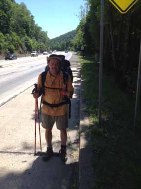
On the back side of the mountain I met a day hiker. He asked if I was planning on descending the mountain. I said "yes" and he replied that he would always chose to climb up the rock, and never chose to go down. Reached the rock scramble and decided I would be taking my time.. This was a scary feature and certainly the most challenging section I had experienced. Part way down I met another section hiker taking a rest while climbing up. I took a break with him was we shared our hiking experience, noting that we each thought that the other look familiar. When we shared our trail names as we prepared to head our separate ways we realized that we had spent the night together at the Eagles Nest Shelter just south of Port Clinton the previous year.
Got safely down off the rocks, crossed the Lehigh River, and hiked up to the Outerbridge Shelter where I planned on spending the night. The shelter was in bad shape and the log mentioned snakes, so I decided to move on and take some distance off of the next days hike. Climbed almost to the top of the mountain, about a mile further on, and found a nice grassy campsite along the trail. Hung the hammock and relaxed. 2 women with dogs stopped in and chatted, allowing me to pet their dogs. Fell asleep to the music of three whippoorwills.

My new friend. Beautiful section. Blue Mt Summit Bar
Allentown Shelter, Night 7.
Friday, May 18th, 15.8 miles. Warm and sunny, temperatures in the upper 70's.
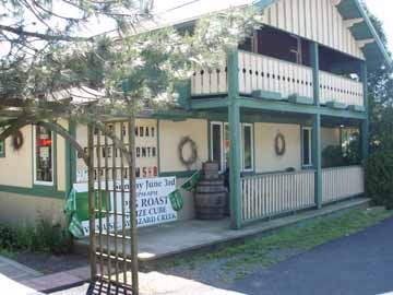
Up, packed, and back on the trail headed south by 6:15 am. Planned on about 10 miles. This was one of my favorite sections on this hike. The trail mostly smooth, level, and followed the crest of the mountain for what seemed like miles. Met 3 women day hikers headed north to The Bake Oven and they suggested that I stop at the Blue Mountain Summit for lunch. Got to the blue blaze to The New Tripoli Campsite at 1:15 pm. Pumped for a hot meal I hiked the 1.8 miles to RT 309 and the Blue Mountain Summit Bar and Restaurant in 30 minutes. Had a cheese burger, fries, a Blue Moon draft, and 2 cokes. The restaurant was hiker friendly so I filled my water bottles and put some charge on my phone before moving on.
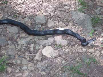
Leaving I planed to hike a mile or so and find a campsite for the night. After a short hike through the woods the trail came out on a level grassy mountain road. Met a guy walking his dog who informed me that the trail was pretty easy all the way to the Allentown Shelter (the shelter had a privy). Decided to try to make it to the shelter. Hiked partway with a guy looking for a friend that was coming northbound. I was surprised to learn that he was a professor at Bloomsburg University, where I lived for 9 years. Arrived at the shelter about 4:15 pm. Already 4 through hikers there and one tagalong. Saw a 4 and 1/2 foot black snake stretched across the road.


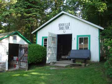
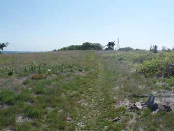
No Rocks. Where is the trail? Eckville Shelter, 8th night.
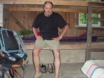
After the shower.
Saturday, May 19th, 7.4 miles. Very warm and sunny, temperatures in the mid 80's.
Left the Allentown Shelter at 7:15 am headed south to the Eckville Shelter. Weather was sunny and warm, 80's. About .50 miles south the trail became rocky, big rocks, and continued for about 3.5 miles. For me this was one of the worst sections for rocks that I have faced. Then the trail became much smoother and went down hill for a good distance, followed by a short uphill to the road and then down the road about .10 miles to the Eckville Shelter. Arrived about 1:00 pm. Needed a rest from the rocks. Eckville is a very nice enclosed shelter with a caretaker present onsite. Also has a solar shower!!! My first shower since I started a week ago.
Had lunch, showered, read information left at the shelter, and rested. After talking to the caretaker I phoned Tina and left her know that I might be able to get to Port Clinton Sunday, a day early, if she could pick me up. Another southbound section hiker came in about 4:00 pm. He was pretty well beat as well. It was easy to see why as his pack had to be about 60-65 pounds. He had started a through hike in Georgia early in March, but had to be rescued after the weather turned bad and he, and his equipment, became soaked. Just the two of us in the shelter for the night.
Sunday, May 20, 14 miles. Warm and sunny, temperature in the 80's.
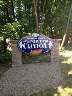
Up at 5:30 and ready to leave at 6:15 am. I called Tina and told her I planned to be in Port Clinton about 2:00 pm and she said she would pick me up. I asked Bill (the other section hiker who spent the night) if he wanted to walk along since we were both headed south. He agreed and we left Eckville at 6:30 am. The trail was woods roads all the way till the blue blaze to Windsor Furnace Reservoir. The trail was surrounded by older growth trees and nice streams flowing along the trail. Arrived at the reservoir and could not find any blazes. Used Google Earth on my iPhone to find our way back to the AT, which was at the bottom of the reservoir.
Bill said goodbye and left for the parking area to meet his son. I continued on making the climb to the top of the mountain seeing a garter snake along the way. Met a day hiker who gave me a 10 minute lecture on the American Chestnut tree and how there were hundreds of small trees trying to make a comeback. I continued on along the spine of the mountain where I had a view of Cabelas. Began my decent and went through a burned area. Had been a pretty big fire in the not too distant past. Stepped out of the woods at the parking area and headed toward Port Clinton on RT 61. Tina passed me while I was walking along RT 61 and blew the horn....what great timing!!! I followed her to the parking area for the trial headed south out of Port Clinton, where I left last year. Pennsylvania Done!!!
PS. I had noticed a lump on the left side of my neck in early April. Checking for information on the internet I learned that it could be an infected lymph node and that if it persisted for more then a mouth I should consult a doctor. I arrived home on May, 20th, called my doctor on May 21st, and saw my doctor on May 22nd. After an MRI, surgery to have the swollen lymph node removed and sent to pathology, and a PET/CT scan I was informed on June 12th that I had throat cancer. Never smoked a day in my life. I had to be the healthiest sick person ever. I am happy to report that after 36 radiation and 3 chemo treatments my scans are great and I am in the process of regaining my strength and stamina to make another 100 mile hike again this year. For this I thank God.
Footprints
Updated: 03/29/2013 09:03:06 AM