Day 3: The Journey In
Monday, August 25, 2003
I think I set the alarm for 5:45am, but I wake up at 5:30. Well didn't the room cool off nicely during the night. In fact, it's darn cold. I stumble out of bed and get things going. I want to be all but out of here by the time breakfast rolls around.
I arrive at the Canyon cafeteria right at 6:45, at least by my watch. I see Tim's van and Jake and Leslie's van. I find Tim right inside the door, Leslie shows up a minute later. Jake is doing Jake-like exploring in the cafeteria, I guess. We collect our breakfasts and settle in to enjoy ourselves. Tim wonders out loud if we are the only ones who speak English as a first language. We do seem to be a minority. Those tour buses sure hold a lot of people.
When breakfast is over I tell Jake and Leslie that I need to get out of my room and turn in my key. I will meet them at the trailhead. Is it really going to happen? I pull out of the parking lot, stop to put my key in the drop box and head down to Canyon Junction. A left turn later and I am on the road towards the Chittenden Bridge and the picnic area parking lot. I pull into a space next to Jake and Leslie and start pulling out my gear. I am nearly ready to go, having taken care of everything at the cabin. Jake and Leslie are throwing the last few things into their packs. Tim is there to see us off. He is off at the trailhead signing us in.
But there is a problem. A sign at the trailhead says the trail is closed due to fire. There is no date on the sign. A debate breaks out. I got the permit only yesterday. Surely the rangers would have told me if the trail was closed. So we should be able to go. On the other hand, we don't want to walk into a fire. We decide to go back to the Canyon backcountry office and find out what is going on. Tim is disappointed. He wanted to see us off, but now he can't. He is going to the north gate for the 100th anniversary celebration of the Arch and he needs to leave. So we say goodbye to Tim and Jake, Leslie and I pile into my van and head back to Canyon.
When we walk into the backcountry office the ranger says, "Hey, I know you." I smile. Then we explain the problem. He gets on the phone and starts to work it out. Another ranger says that he is sure the sign is old and should have been taken down. After a few minutes on the phone we find out that the trail is open and that we can go. The rangers all agree that we did the right thing.
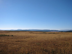
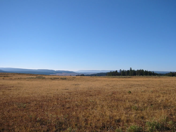
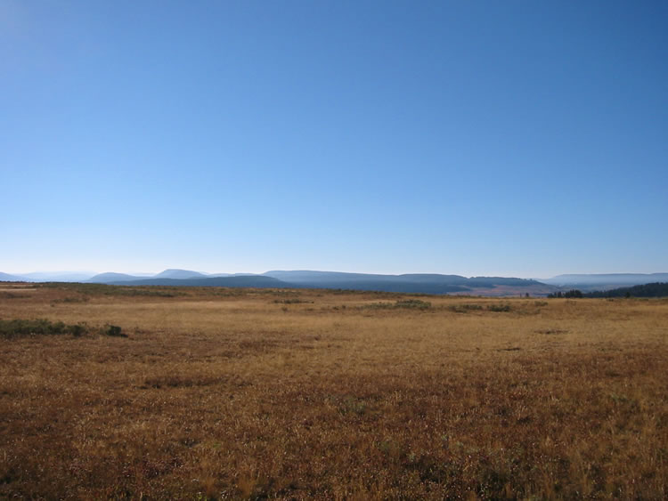
 So it is back to the trailhead. I am a little concerned now that Tim left. Now no one knows if we've actually left. Once again we strap our backpacks on and head towards the trail. I check the register. Tim signed the book, "Geyser Gary". Cute. I am pushed out in front to set the pace on the trail. It is a beautiful day, mostly clear with only a few clouds in the sky. As we head through the north end of Hayden Valley we can see the smoke from the fires settled into the south end of the valley. Today we cannot see the steam from the thermal areas. When we get to the top of the first hill, I stop for a few photos. I really regretted that I did not have photos from this spot on the last trip.
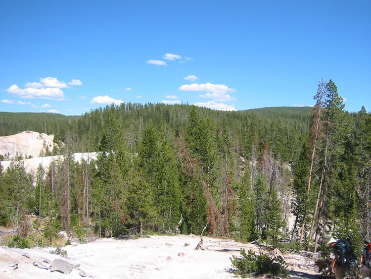
 Jake tells me the story of the bison on the trail on the first Fairyland trip and how they were detoured around on the lakes loop trail. That is so like a bison. I love the views of Hayden Valley out here. It is truly gorgeous. To the north we see Mt. Washburn rising across the Grand Canyon of the Yellowstone. Further to the west are the hills the mark that northern boundary of Cascade Lake and Grebe Lake. Life is good. Jake and I start talking about the mental milestones along the way. A lot of this trail runs through deep lodgepole forest that is not that interesting. First we must get to the thermal areas on the edge of the forest; then to the junction with the Lakes loop trail; then we need to get to the creek that runs along the trail; then to "disappointment meadows" and then finally to Moss Creek.
 As we cross Hayden, Jake spots the the largest animal we will see the entire trip. A coyote scampers away from us. He (or she) is very nearly the color of the grass. Although we will see lots of evidence of other large animals, we will see nothing larger than squirrels, osprey and grey jays the rest of the way.
Whenever there is a lag in the conversation, Jake breaks into song. It's always a catchy tune that you can't get out of your head and it's always at least 25 years old. Someone needs to teach Jake some newer tunes. Jake keeps this up throughout the hike.
Jake hates the eight miles of trail we must hike and he certainly doesn't hide it. He complains at every opportunity. It's okay, it doesn't matter. This is just a matter of doing it. The trail is not difficult. We just have to knock off the miles.
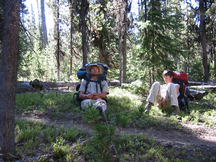
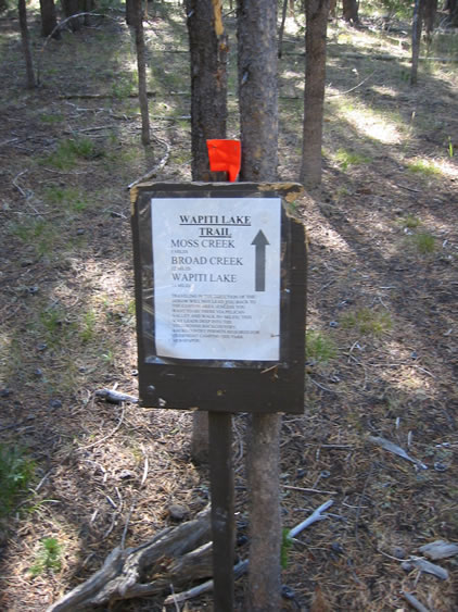
 My plan is to stop every forty-five or fifty minutes for a ten minute break. I know that by doing that we'll make more than two miles an hour. Secretly I am hoping to make the Ribbon Lake trail junction marker for the first stop, but we don't quite make it. Psychologically it's a great thing when we get there. I stop to take a photo of the sign that Tim got the NPS to put up. Good job, Tim.
So we press on. While the trail is mostly flat, it also gently climbs. It's not bad. In fact, if we didn't have to travel eight miles, I would rate the trail easy. If the bushwhack is added as part of the hike, then I have to rate the route as moderate.
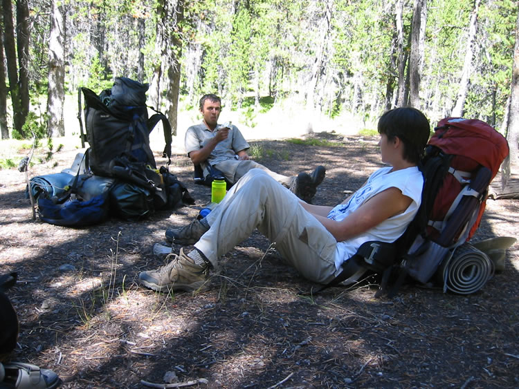
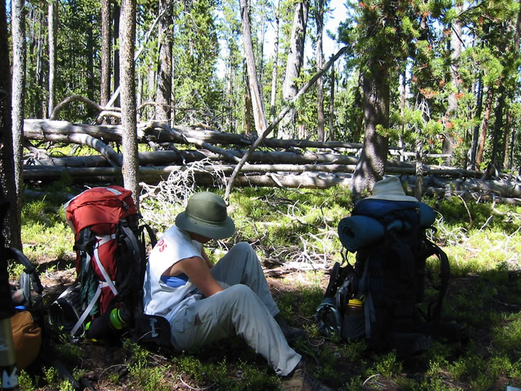
Two breaks later and we find ourselves approaching Moss Creek. This is good news. It took us three hours and forty-five minutes to get to Moss Creek. Now that I have done the trail one time the trail seems shorter. Jake says that he thinks we are making pretty good time. Laurie and I did it slightly faster, which is, I think, a little understandable. Sometimes during breaks the conversation grows so pleasant that we forget about the time. Leslie and I find a shady spot near the creek to pump water. Since my MSR water filter is the only one we have with us, I show Les how it works. Moss Creek is the last "easy" water we will have for a while. The rest of our water supply has so many minerals in it, or other thermally substances, that pumping water becomes a real chore.
After we finish pumping water, we climb the little hill on the east side of Moss Creek near campsite 4M2 to have our lunch. It's a nice shady spot and there are some logs around that we can use to lean against. One of the logs has a big spike driven through it. Could this have been the food preparation area for 4M2? My lunch is a peanut butter sandwich, baby carrots and Doritos corn chips. I love it--it's my favorite hiking lunch.
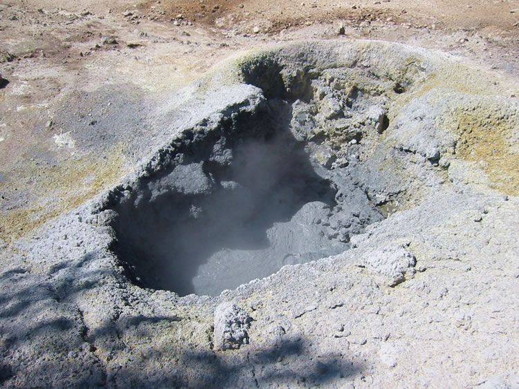
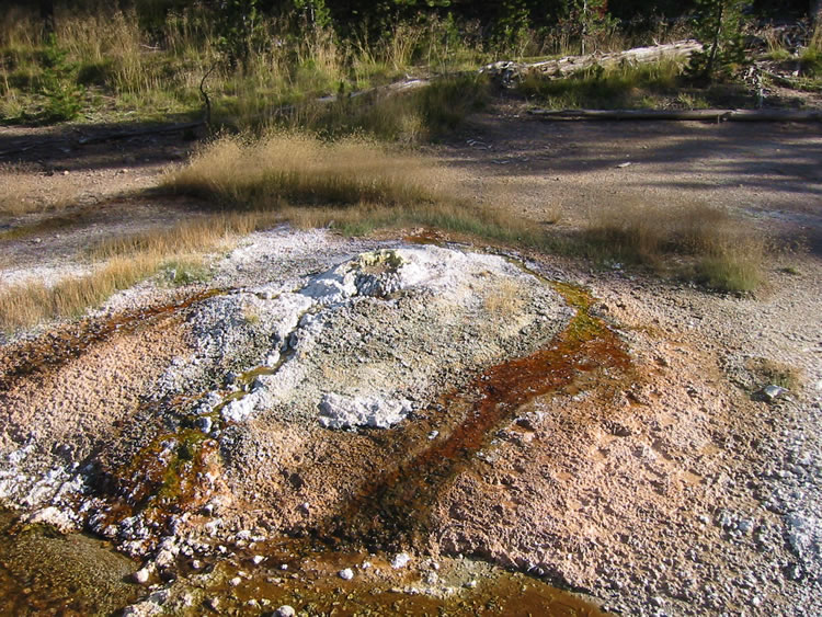
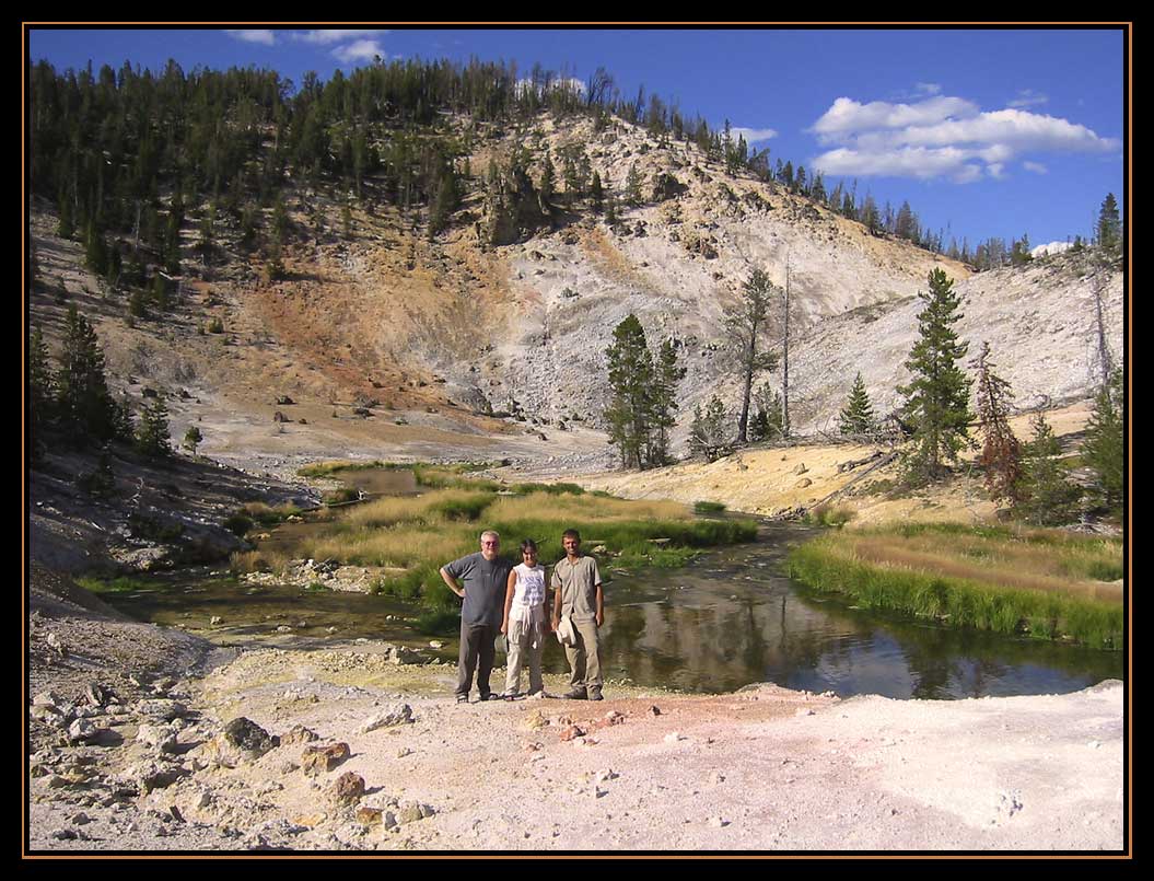
Since we are at leisure, we take a moment to discuss the route we will take to 4B1. Jake wants me to show him the way Laurie and I took last time. I want to see Jake's route. Leslie wants Jake to take the easiest way. I am all for that. I promise Jake that I will take them to where Laurie and I camped once we have set up camp at 4B1. I also want to take a look at the big mud pot. Laurie loves mud pots and I want to get some photos and a little video for her.
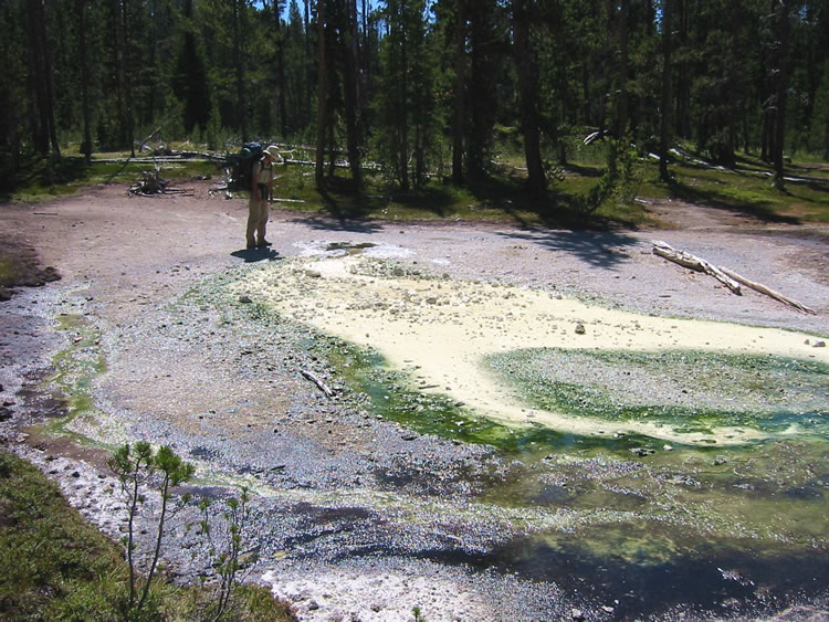
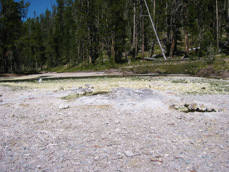
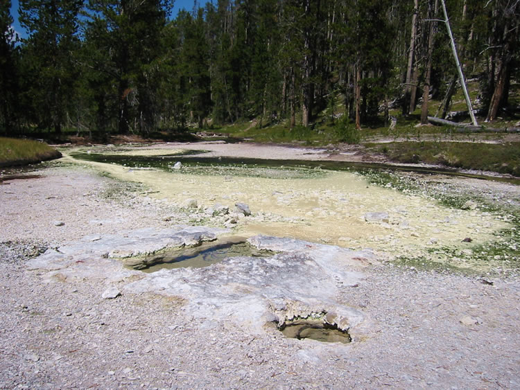
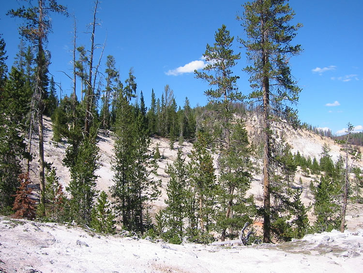
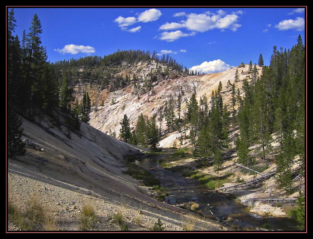
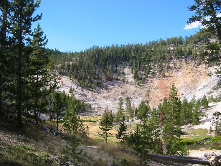
With that we head back to the trail for the short hike to Orange Rock Springs. This section of trail seems longer to me than it should, probably because we are so close to our jumping off point. So we travel around the hill that is home to 4M2, hook up with the creek that flows by Orange Rocks Springs and after another curve in the trail we begin to the see the bright green mossy stuff that is characteristic of the runoff from Orange Rock Springs. Once at Orange Rock we stop for a few minutes to take a few photos and to take a closer look at the thermals.
We don't spent much time at Orange Rock. The stuff that we really want to do today is all at Joseph's Coat Hot Springs. Whereas Laurie and I went straight up the hill from Orange Rock, Jake takes us around a little bend in the trail. There is a bit of a draw there that offers us an easier route. Jake pulls out his map and compass and we head off-trail into the woods.
I keep a pretty close watch on Jake. I know what he is doing and I am interested in his compass readings. We briefly discuss orienteering and sighting trees. Jake says that he was sighting one tree after another when they went to Rainbow Springs three weeks ago. Leslie laughs. "He's looking up at the trees and I say, 'What are you doing?'" I'll admit that Jake is usually pretty subtle about his sightings. After about 25 minutes and some up and downs, we come across our first landmark, the creek that Laurie and I followed down to Joseph's Coat. We are now roughly a half-mile into our two mile bushwhack.
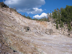
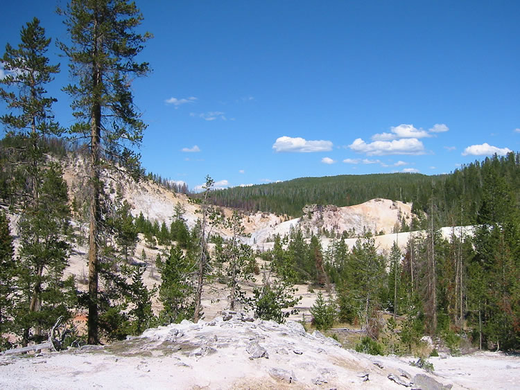
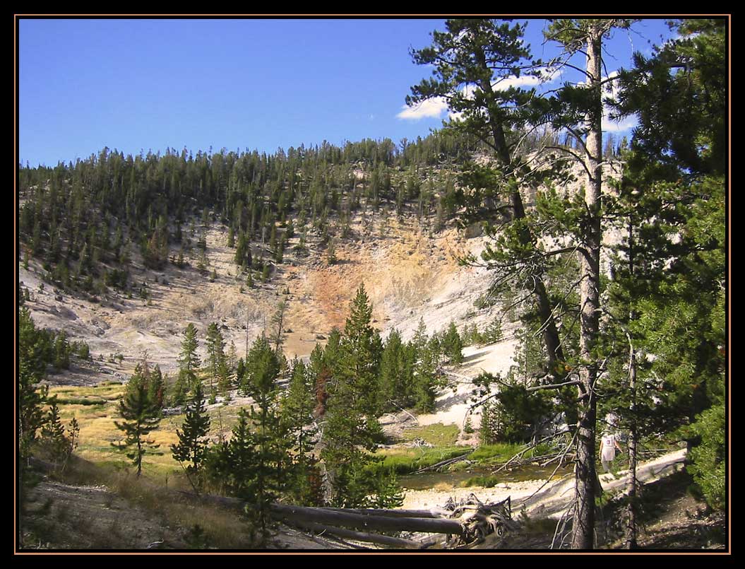
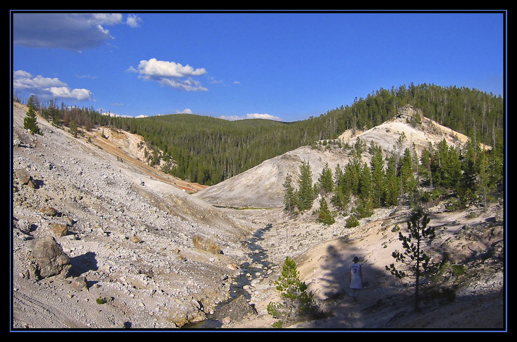
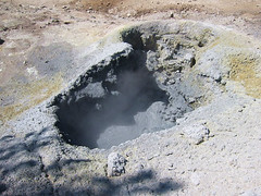 We hop the creek and mostly follow the draws through the forest. We don't stop often now. There's some deadfall to cross, but it is not bad. Leslie says that she thinks that Jake has improved in route-finding over the years. He used to just go straight over the deadfall. After about an hour we start heading down. We can see the sinter walls of the canyon that is home to Joseph's Coat. Before you know it, Jake leads us out of a grassy area and onto a sinter-like ridge. "Here's the mud pot," says Jake. It's just like Jake to take you straight to the thing you want to see. I take a few photos and some video for Laurie.
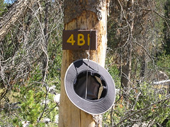
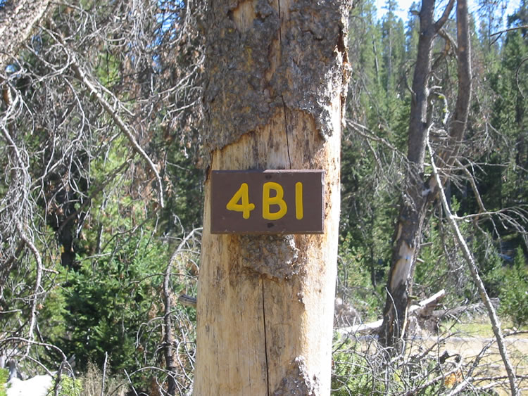
 It is now just a short ways to 4B1, although we do have to get down off the ridge where the mud pot is. Before you know it Jake says, "There's the bear pole. We'll set the tents up here." He plops his pack down. I take my pack off too and head over to check out the food preparation area. Sure enough, there's the 4B1 sign. I take a look at Broad Creek and then down Broad Creek. Although the angles are wrong, I think I recognize some boulders on top of the hills downstream a bit. Last time I just never came quite far enough down stream to find Broad Creek.
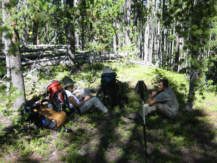
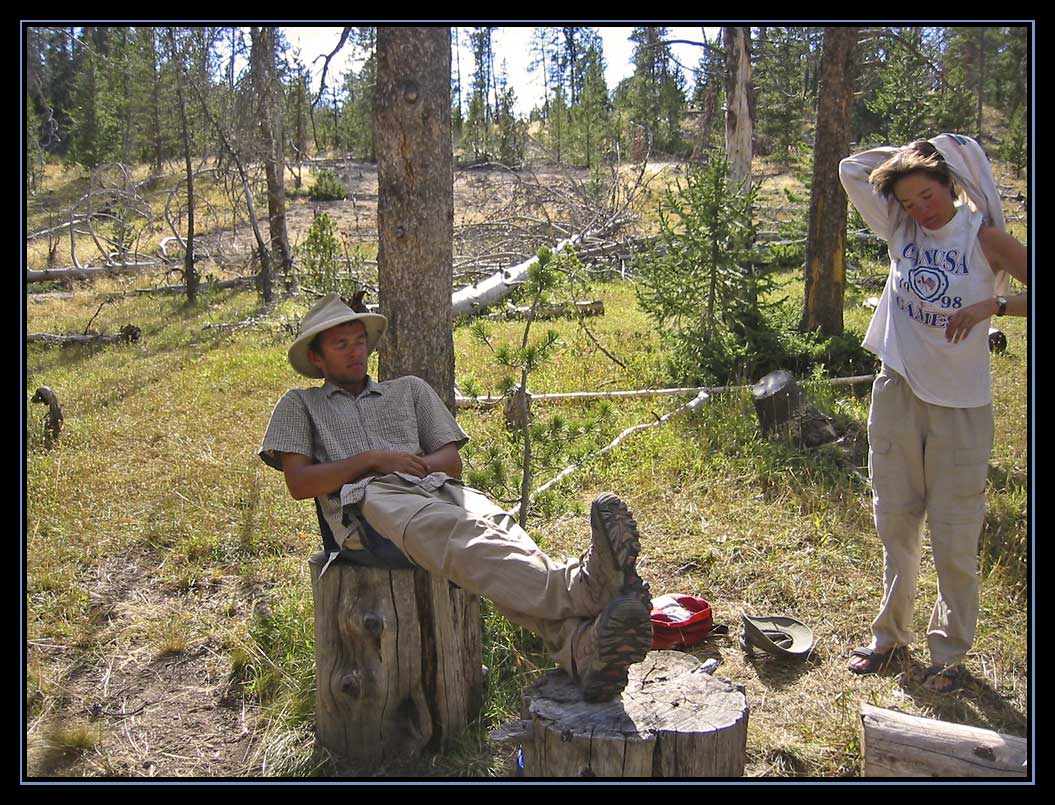
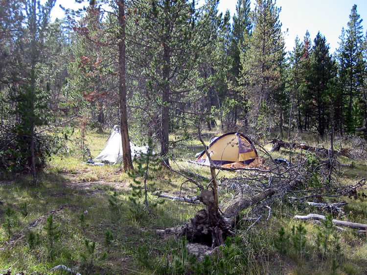
Jake and Leslie are busy setting up their tent. I walk around a bit looking for a piece of level ground that pleases me. I need to have a good night's rest tonight and I know I am going to want a good night's rest after Fairyland. I want to choose my site carefully. Finally I decide on a location, just to the west and south of Jake and Leslie. I ask if I am too close. They say no. I dump everything out of my pack and start setting up my tent.
 We end up using my parachute cord to hang the bear bags. At the fire ring I start spreading water bottles and filters, stoves and fuel around. Somehow my ditty bag ends up over here. Jake takes out his Crazy Creek chair and lounges around. It's so pleasant that we almost forget the afternoon is wasting away. We still have stuff we want to do today. Plus, from a photographic point of view, the light isn't going to get any better today.
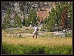
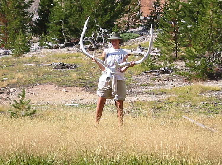
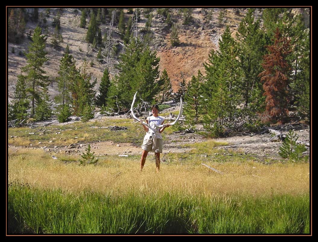
Somehow we rouse ourselves--probably through Leslie's doing--and head off down Broad Creek. Jake takes us down over "The Shoulder" to the little island. There we talk about recreating the photo of Jake holding the elk skull. I insist that we use the best model available to us, so we send Leslie across the creek to hold the skull. First she does it with her hat on, but I notice the shadow over her face. So we do it again with her hat off. The amazing thing is that the skull has held together all these years.

Not far from the island we find the creek that I believe Laurie and I camped by. We turn to follow the creek upstream. As we go, I am certain this is the right spot. We cross a tricky hill that is full of small ball-bearing sized pebbles that are all poised to send you skidding down hill to the creek. Of course Jake and Leslie go straight across without a problem. I slip, fall a bit and scrape my elbow. It is the first of my Fairyland injuries. Once we have crossed the slippery hill, we find another hill that I am sure is the farthest point that I explored. In a short distance we find where we hung our food and where we prepared and ate our food. I take Jake and Leslie up the little hill to our campsite. They both agree that it is a very good campsite. I even point out where I stuck my hiking poles in case they came looking for us. One thing is clear. As long as we stayed there, we were never going to find 4B1 or Jake and Leslie and as long as they stayed near Broad Creek they were never going to find us.
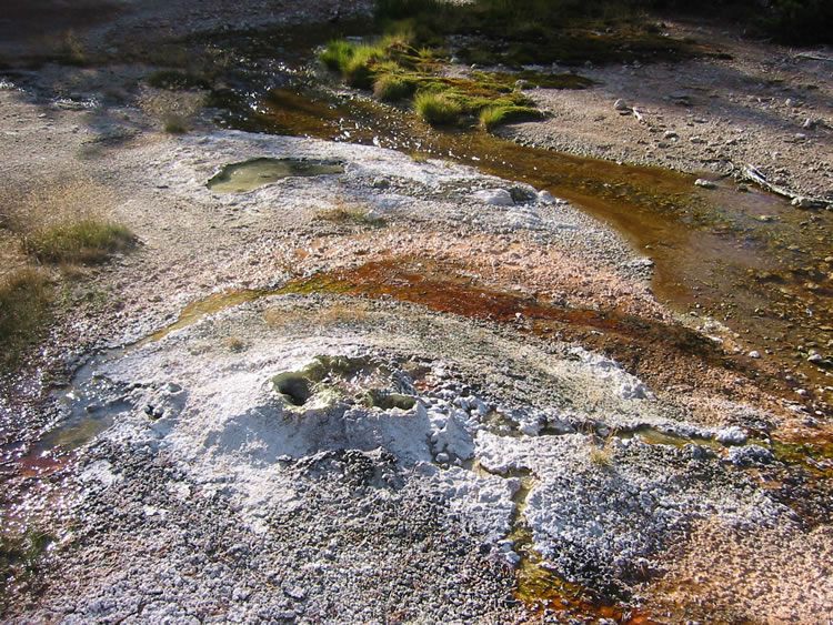
So we continue up the creek to explore the large hill with the fumarole that Laurie and I found last time. I show Jake and Leslie where the creek turns and joins another runoff-type creek. This is the creek that Laurie and I followed down into the canyon. We hop across the creek. I told Jake that I was confused because I was not sure which creek was the dominate creek and which creek joined what. Jake says it is a close call, but he thinks the creek we are now following is more of a thermal runoff creek while the other creek is the main creek. Now that I have seen satellite photos it is easy to see that Jake is right. It's a tougher decision when you are standing at the confluence of those two unnamed creeks.
 A little further upstream I show Jake and Leslie the big hill that Laurie and I climbed. Soon we find the big noisy fumarole that Laurie and I found. Then we head up to the streamside thermal feature that Laurie and I found. Jake and I wonder if this is Whistler Geyser. Although low to the ground and small it has some development around it like it may be in the process of cone building, but there really isn't any periodic activity. I have since communicated with Lee Whittlesey who indicated a different location for Whistler Geyser.
Jake and Leslie head up the hill to explore a bit. I decide to head up the stream some more to see what is over the hill. What I find are some more small steamers. It's not too far until the thermal area appears to gradually disappear. So I turn around and make my way back to the others. As I get over the little hill I find Jake and Leslie coming my way. Jake wants to know what is up there. I tell him that the sinter area ends just up the creek. With that we turn and start heading back to 4B1.
When we get back to camp Jake says that he wants to go find the fire ring that he and Tonya found last year. So he heads across Broad Creek to find that again.
I try to make good use of the late afternoon sun. I know that this may be my best photographic opportunity in Joseph's Coat. I want to be able to show Laurie the relationship between the spot where we camped and Broad Creek and hence 4B1. When we get back to camp it is time to get dinner going and pump some more water. We find that we can only pump about one and a half bottles before we have to clean the filter. It is a slow way to pump water. All dinners tonight consist of macaroni and cheese. Jake and Leslie also make some potatoes. I have some fresh carrots that I have brought along and I eat some jerky as well.
 It is not quite 9:00pm. Camp chores are done and the bear bags are hung. There is nothing much to do now but sit around. I know I cannot go to bed too early. I start wondering about the weather tonight. It seems warm enough now, but I decide almost at the last minute to put the rain tarp on my tent. It will help maintain warmth, even if it doesn't rain. We talk about what time we should leave tomorrow and what time we should get up. I tell Jake and Leslie that I have my little travel clock with me. We agree that we will get up at 6:00am when there is enough light to take care of morning camp chores. Jake and Leslie decide to go to bed. I would like to stay up at least until 10:00, but I know this probably won't work. I have my fleece jacket on and I am getting a bit of a chill. I try to stay out until 9:45, but I don't think I managed that. I put my headlamp on and take care of a few a things in my tent. Then I decide there is no reason to fight it and I pull the sleeping bag over me and after a couple of turns and adjustments slowly fall asleep.
On to the next day
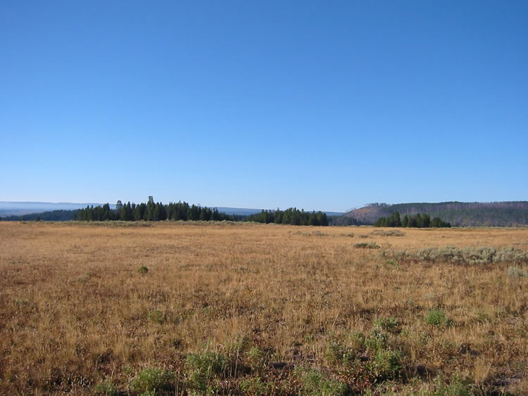 So it is back to the trailhead. I am a little concerned now that Tim left. Now no one knows if we've actually left. Once again we strap our backpacks on and head towards the trail. I check the register. Tim signed the book, "Geyser Gary". Cute. I am pushed out in front to set the pace on the trail. It is a beautiful day, mostly clear with only a few clouds in the sky. As we head through the north end of Hayden Valley we can see the smoke from the fires settled into the south end of the valley. Today we cannot see the steam from the thermal areas. When we get to the top of the first hill, I stop for a few photos. I really regretted that I did not have photos from this spot on the last trip.


