GEOG 5224p Final Project: Designing a 911 Update ApplicationScott Horn, Brenda Ress, and Tom Wells
1.0 Background and Introduction The City of Nittanytown is interested in developing a roads layer in support of their 911 system. Each road segment will store the road's name, direction, thoroughfare type (Rd, Ave, etc.), and address ranges. The parcel layer already exists and each parcel has been assigned an address in the attribute table. Data technicians will digitize roads using the parcel layer as a backdrop and will use the parcel-level addresses to populate the following road attributes:
The goal is a customized application that offers both greater speed and accuracy. VBA code and forms were used to build a customization that meets this overall goal. The application developed assumes that the technician will handle adding and symbolizing the road and parcel layers, setting the snapping environment, and starting and ending the edit session. One form used includes drop-down menus for certain fields and performs error checking to ensure that valid entries are made.
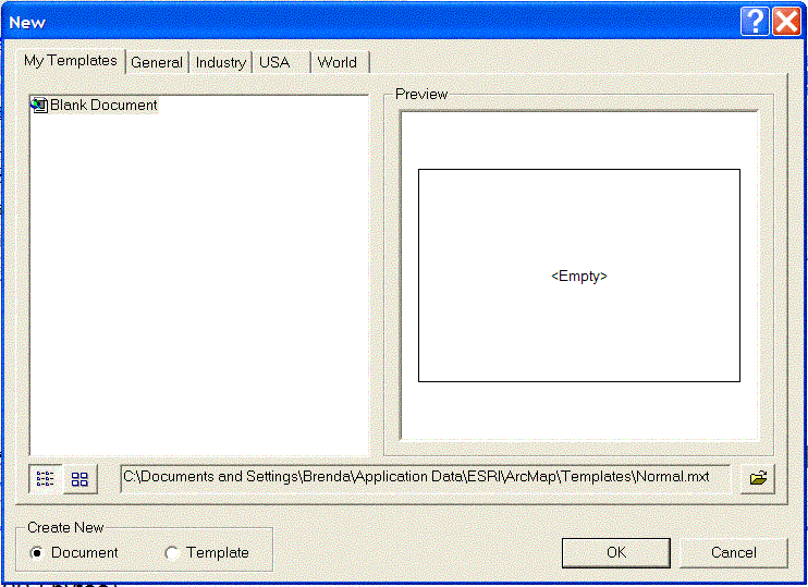
2.0 User Instructions 2.1 Template Installation The following describes the installation of the template onto the user's PC. The template will be used to support the development of the Nittanytown 911 system. 1. Locate template, 911_Data.mxt on disk or CD. 2. Save file in C:\Documents and Settings\Personal Folder\Application Data\ESRI\ArcMap\Templates\ directory on the PC. The portion of the file path, 'Personal Folder' , is meant to represent the folder of choice of the person using the system. Figure 2.1 below shows the file path with the hypothetical user 'Brenda' for the 'personal folder'. Also in this folder is normal.mxt which represents 'Blank Document' shown below in My Templates.
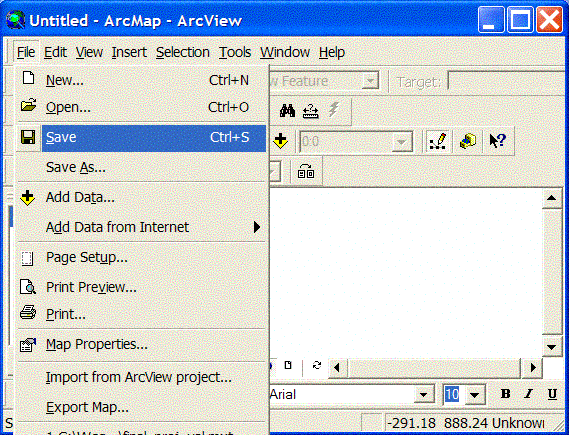
Figure 2.1 Templates Directory 2.2 Instructions for Use The following instructions generally step the user through creating a new ArcMap file and digitizing road segments. 1. Open ArcMap. 2. Open new file: File > New. 3. Load 911_Data.mxt: File>Open>C:\Documents and Settings\Personal Folder\Application Data\ESRI\ArcMap\Templates\911_Data.mxt. 4. Save new ArcMap document (Figure 2.2): File>Save As... or File > Save.
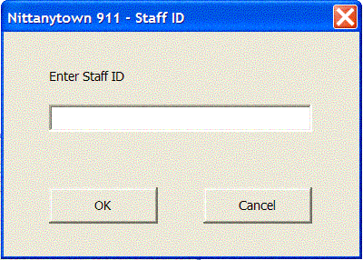
Figure 2.2 Save New ArcMap Document 5. Add Roads and Parcels from the Nittanytown.mdb from ArcCatalog. 6. Click on the 911 Tool. An input box for entering Staff ID should appear. 7. Enter your Staff ID into the form and click OK (Figure 2.3).
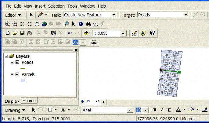
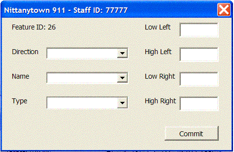
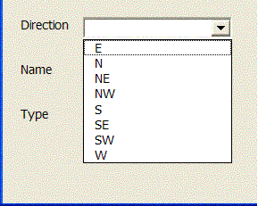
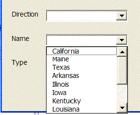
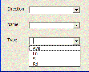
Figure 2.3 Staff ID Form. 8. Click on two points to create a road segment (Figure 2.4). Figure 2.4 Creating a Road Segment. 9. Hit F2 to finish sketch or double click on the second point. 10. Enter information into form. Figure 2.5 below shows the form with hypothetical Staff ID while Figure 2.6 exposes the contents of the drop down menus.
Figure 2.5 Form for Entering Road Segment Data
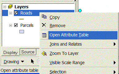
Figure 2.6 Choices in Drop Down Menus for A) Direction, B) Street Name, and C) Street Type. 11. Click Commit to save the information describing the newly digitized roads. This new data is stored in an attribute table along with Staff ID and Time Stamp (Figure 2.7).
Figure 2.7 Attribute Table Containing Information on Newly Digitized Roads. 12. Correct any errors in data entry. 13. Click Commit. 14. Click on two points to digitize a new road segment. 15. Hit F2 to Finish Sketch or double click on the second point. 16. Enter information into form. 17. Click Commit to save. 18. Correct any errors in data entry. 19. Click Commit. 20. Continue digitizing roads, remembering to periodically save the document.
3.0 Final Comments on the Project The template created in this project meets the goal of customization set forth in Section 1.0, including drop down menus and error checking. The one drawback to the desired template was the lack of Staff ID information. There was no way to truly validate the User ID since there was no information (database) given on existing IDs. What keeps a technician from entering the wrong ID continually or having a person with ill intent use the system with a fabricated ID? No ID security exists and will not until more ID information is available.
|
|
4.0 Bibliography ArcView.ArcGIS.ArcMap.ArcCatalog. http://www.esri.com/. Copyright 2002© ESRI. Viewed July 13, 2003. Last Updated July 1, 2003. |
|
Last Updated: March 24, 2004 |