RED RIVER FLOOD INFORMATION
Updated each spring since 2010
railroad bridge @ Oslo
NWS River Levels HERE
USGS Streamgauges

CANADIAN INFO

Inform your Friends

Contact Me
2016 Red River of the North
Flood chance is VERY LOW

Read the
UPDATED 2016 NWS Statement

Pembina County road dike dispute headed to court


MOVED > WEBCAMS And Archive < MOVED

ROAD CLOSURES

North Dakota
Road Conditions
511 or 1-866-696-3511
1-866 (MY ND 511)

NW Minnesota
Road Conditions
Just dial 5-1-1 and say the name
of a city or say menu.

Manitoba
Road and Traveler Information

Grand Forks County
Roads that are closed

Unofficial Driver reported hazards


Daily
NEWSPAPER

FARGO FORUM
GRAND FORKS HERALD
WAHPETON DAILY NEWS


MEDIA:

TELEVISION
The local television stations
keep extensive Closure and Flood
information

WDAZ

KVLY / KXJB

RADIO
Fargo
*
KFGO 790 AM
WDAY 970 AM

Grand Forks
* KNOX 1310 AM

Crookston
* KROX 1260 AM

Grafton
KXPO 1340 AM

* denotes online stream available

Cities

Wahpeton

Breckenridge

Fargo - Fargo First Link
City of FARGO on twitter

Moorhead

Grand Forks

East Grand Forks
(218) 399-3456

Oslo, MN website
(218) 695-3841(City office)

Drayton, ND website
701-454-3590 (City office)

Pembina, ND website
701 825-6819 (City office)

University
UND Flood Information
NDSU Flood Information
COUNTIES
some have lists of closed roads and other flood information
NORTH DAKOTA

RICHLAND
CASS CNTY Cass Co. E.M. Blog
TRAILL
GRAND FORKS
WALSH
PEMBINA

MINNESOTA

WILKIN
CLAY
NORMAN
POLK
MARSHALL
KITTSON

For 24/7 weather and river info,
NATIONAL WEATHER RADIO SERVICE
24 hr Weather and reports, current levels, projected crests
and any Emergency Announcements
RRV area
COVERAGE MAPS

NOAA Weather Radio All Hazards (NWR) is a nationwide network of radio stations broadcasting
continuous weather information directly from the nearest National Weather Service office.
More Information
HERE
Receivers for this service available at many local hardware stores
and most larger retailers
Home of Economy, Best Buy, Kmart, Walmart, Target.

Ask for a Weather Alert Radio.


FEDERAL & STATE LINKS

www.disasterassistance.gov
   www.floodsmart.gov

www.fema.gov/   USGS flood info ND  Minn.
 

MINNESOTA
HOMELAND SECURITY AND
 EMERGENCY MANAGEMENT
NORTH DAKOTA
DEPARTMENT OF
EMERGENCY SERVICES

RED CROSS
SALVATION ARMY
The Red River Basin Decision Information Network
offers a one-stop shop for flood and weather information Are you wondering whether your home might be threatened by flooding this spring?
If so, are you considering a sandbag dike around your house and garage?
Do you have any idea how much sand that might take, or what it could cost?

You can find that information with just a few clicks on your computer.
If you live in the Fargo area, you have access to another interactive tool: a flood inundation map, where you can view, block by block, what would be covered by water when the Red River is at, say 30 or 36 feet, and how it would spread out at 36.5, 37, 38 feet and beyond. For now, the inundation map is specific to the Fargo area, from just north of Argusville, N.D., south to North Dakota Highway 46.
They hope that by next spring the Fargo-Moorhead piece will be expanded to include the entire mainstem Red River, all the way to the U.S.-Canada border,

http://www.rrbdin.org/

Canadian links.

City of Winnipeg | Flood Information
Province of Manitoba | Flood Information
CBC Manitoba | Flood 2013
CTV Flood Watch
Winnipeg Free Press
Manitoba Road and Traveller Information


AFTER THE FLOOD THESE PAGES WILL REMAIN
WITH LINKS TO ALL YOUR SHARED
PHOTOS

SHARE
Inform your Friends

For you that want to write it down use
http://tinyurl.com/redflood

Contact Me at
floodwatch2011@mt2015.com
for Inclusion of another informative website,
link to your webcam or photos of the river,
Correction of an error, or just a comment.
Thanks!

Thanks for your Email!
I will not share, or save your email address, in any form.

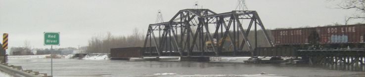
FYI: Images on the top of these pages are from 2011

TOP