What’s This Website All About?
Do you have a need to know where boat ramps are located on the Western Rivers? Are you a crewmember on a towboat, looking for a spot to do a crew change? Are you a crew dispatcher, looking for a more efficient way of getting people to and from a boat? Does your business involve working on towboats; for instance, radar repair, refrigeration repair, engine work, electrical work, delivering groceries? Do you run a limo service that transports crewmembers? Or are you a fisherman or pleasure boater, and would like to know accurate locations of boat ramps in an area that you would be going to?
If so, the information in this web site is for you! Using the information provided here with either a hand-held GPS receiver or an in-vehicle navigation system, we can help you get to the place you want to go. Simply enter the coordinates for the boat ramp that you wish to go to into your GPS receiver and tell it "Go to"! Your unit will then give you directions to the chosen boat ramp!
This information also covers more than just boat ramps for the people who work on the rivers. There are also barge fleet offices, boat stores, fuel suppliers and launch services, hopefully, any place your company does business that has the facilities to get you on or off a boat.
So far, the Lower Mississippi River is the most extensively covered river, only for the reason that that is where the boat that we work on operates. We have covered a small amount of the upper Mississippi (from Cairo, Illinois to Hartford, Illinois) and the Ohio River (Cairo, Illinois to Paducah, Kentucky) because we occasionally run there also. The database also includes the Illinois River, but much of the information is pulled from map data alone. Several points on the Illinois have been pulled in person because one of us lives close to there. All of this is a “work in progress”; we add and update information as we can, and we encourage you to help out! With the help of you, the users, we can expand the database to cover much more territory than it currently does. For instance, you could help us with accurate information for the upper Mississippi, most of the Ohio River, the Tennessee River, the Cumberland River, etc. All that it takes is a GPS receiver and the willingness to take a few notes and to e-mail them in.
We hope that you find the information here useful. If the areas that you need are not covered, please help us out by waypointing the information and sending it in! We will make sure that the database is updated with your information and posted to the Web as soon as possible, and we will give you credit for your contribution on the database.
About the RiverRamp GPS Database
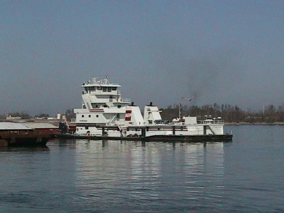
The original idea for the RiverRamp GPS Database had its start in two events, receiving a hand-held GPS receiver for a birthday present and getting lost (badly lost!) in the Arkansas countryside trying to find Fair Landing for a crew change on the M/V Joy Anne Keller. It was pretty apparent that having a list of boat ramps, fleets, tug services, boat stores, and fuel suppliers along the Mississippi, Ohio, and Illinois rivers coupled up with an accurate GPS location of each would greatly simplify trying to find remote boat ramps in rural areas and crew change locations in cities.
We started this database by waypointing the desired locations with the GPS on board the boat and then copying these to Garmin Mapsource. By using Mapsource and City Select, these waypoints
that were out in the river near the boat ramps could then be projected to the bank to the
approximate location of the boat ramp. (You can do this with Streets &
Trips, too. Left click and drag the push pin to where you want it.) The position information was then copied and pasted into Microsoft Excel. Two
files were kept for each river in Excel, one for general use, and for use with Garmin software, and another, with latitude
and longitude formatted differently so that it could be used with the import tool in Microsoft Streets and Trips. Since we
use a Garmin mapping GPS, we keep a separate file of waypoints in the Garmin software and we make a push pin map in Microsoft
Streets and Trips for the benefit of those folks that could use this database but do not have a GPS receiver. If you are using this with Streets and Trips, you can simply copy the latitude and longitude from the Streets
and Trips database in Excel to the Lat. / Long. tab in the "Find" panel, which is available in the edit menu of Streets and
Trips,
to find individual boat ramps, or you can use the "import data" tool to import the whole S&T page for the appropriate
river to make a complete map file.
At this point in the development of the RiverRamp GPS Database, almost all of the waypoints have been recorded from out in the river and projected to the bank. (We still find the occasional new, overlooked or little used ramp, though!) A few waypoints, such as the state operated ferry landings in Louisiana were picked directly off the map, as their locations on the map were very accurate. Any projected waypoints are marked with an asterisk, and waypoints that are placed by map information only are marked with a “pound” sign. As we use these projected waypoints, we will waypoint them again with a hand-held GPS. These positions will be taken from the top of the boat ramp at the center, or from the parking lot of a boat store, fuel supplier, etc. As this is done, we will update the database with the more accurate location. If you have a hand-held GPS, we encourage you to send in your corrections and additions. Take your position reading from the top center of a boat ramp or the parking lot of a boat store or fuel supplier nearest to where you walk down to their dock. An e-mail address will be provided at the end of this document where you can send your corrections and additions. Before they are included in the database, we will proof them against Streets and Trips and City Select for general location.
As of this time, the database will provide you with the GPS location of your final destination only. Keep in mind that this is a work in progress and as we more accurately waypoint locations and process your contributions the accuracy of the database will improve a lot, so please help out by waypointing locations with your hand-held GPS and sending them in!
Getting the database to this point has been the product of many trips on board the boat. John Hutchins and Mike Morris, wheelmen on the M/V Joy Anne Keller, have been generous with their river knowledge. Without their help, this database would have taken much longer to put together, so thanks guys, for all the help. We hope that this information makes finding some of these remote locations easier, and that this helps to make your crew changes smoother and less stressful.
Work safely,
Tom Winkle
M/V Joy Anne Keller