 |
 |
Welcome to the Cascade Narr's latest adventure.
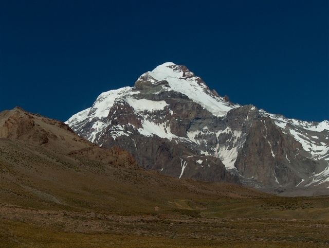
Aconcagua is the highest mountain in the Americas at 6,962
m (22,841 ft). It is located in the Andes mountain range, in the Argentine province of Mendoza. The summit is located about
3 miles from San Juan Province, 9 miles from the international border with Chile
and about 50 miles northeast of the Chilean capital of Santiago. It lies 70 miles west by north of the city of Mendoza. Aconcagua
is the highest peak in both the Western and Southern Hemispheres.

|
 |
This adventure
will have them traveling for days by air and ground. Ground transportation includes bus, riding in the back of a pick-up,
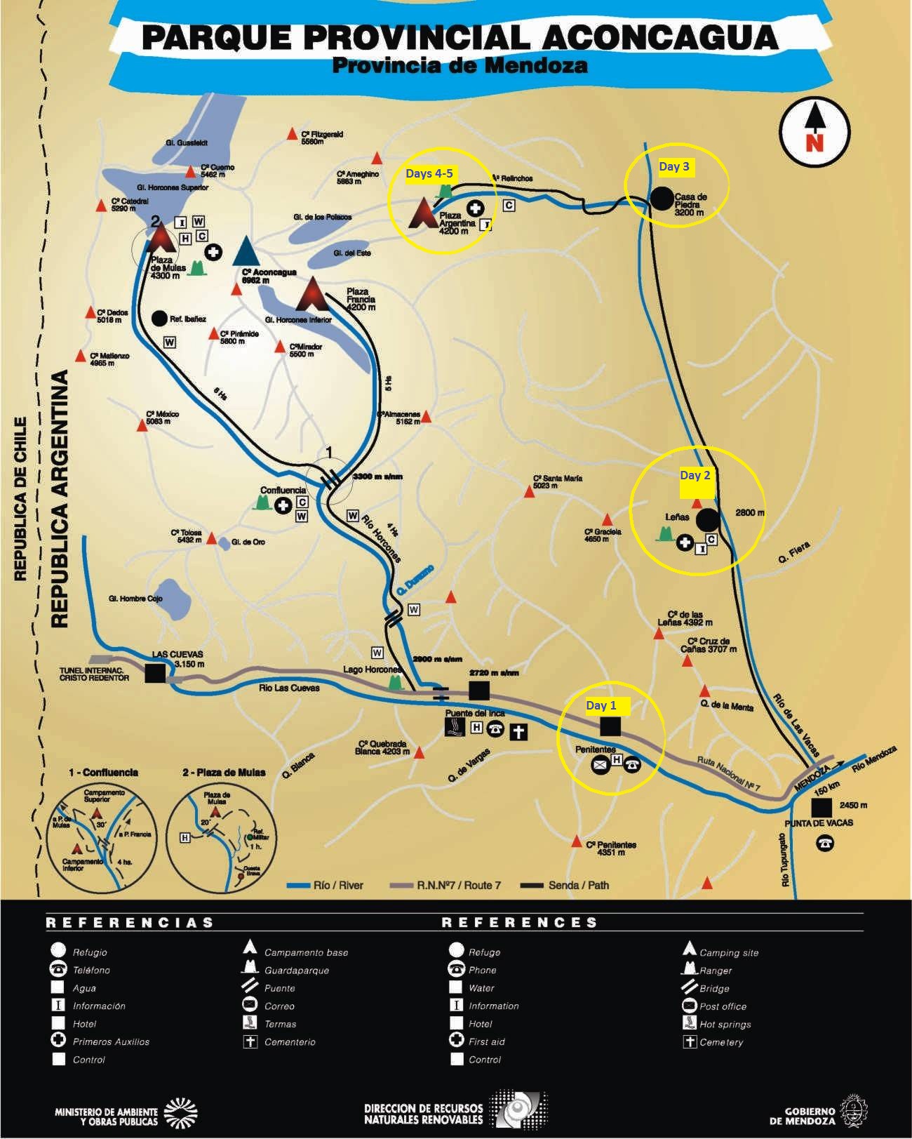
and mules. Yes, I said mules. They will be hiring a mule service to transport their gear up the Vacas Valley from Punta de Vacas (hyperlink to weather there) to Plaza Argentina Base Camp. While some climbers choose to ride
the mules in, the Narrs will be trekking along on foot as part of their altitude acclimation. The trek with the mules includes
a few river crossings as you can see on the approach map below (click on the image to open it larger in another window). Their
daily stops have been circled in yellow and the days indicated correspond to those listed on The Plan.
| Trek to Base Camp |

|
| Click image to enlarge |
Consider supporting another of Aaron's climbs
He will be participating in the Big Climb - a stairclimb up 69 flights of stairs - on March 20th. All proceeds
benefit The Leukemia & Lymphoma Society (LLS). You can support him by clicking the picture below

|
| The Big Climb Seattle |
|
|
 |
 |
|
|
 |
|
You can see images from a live camera at Plaza de Mulas at http://www.aconcaguanow.com/indice4.php. This is the base camp for the Normal Route, which is not the Base Camp for their
route, but it will give you an idea of what the mountain is looking like on a particular day.

Climbing the Mountain
| Climbing Route |

|
| Click image to enlarge |
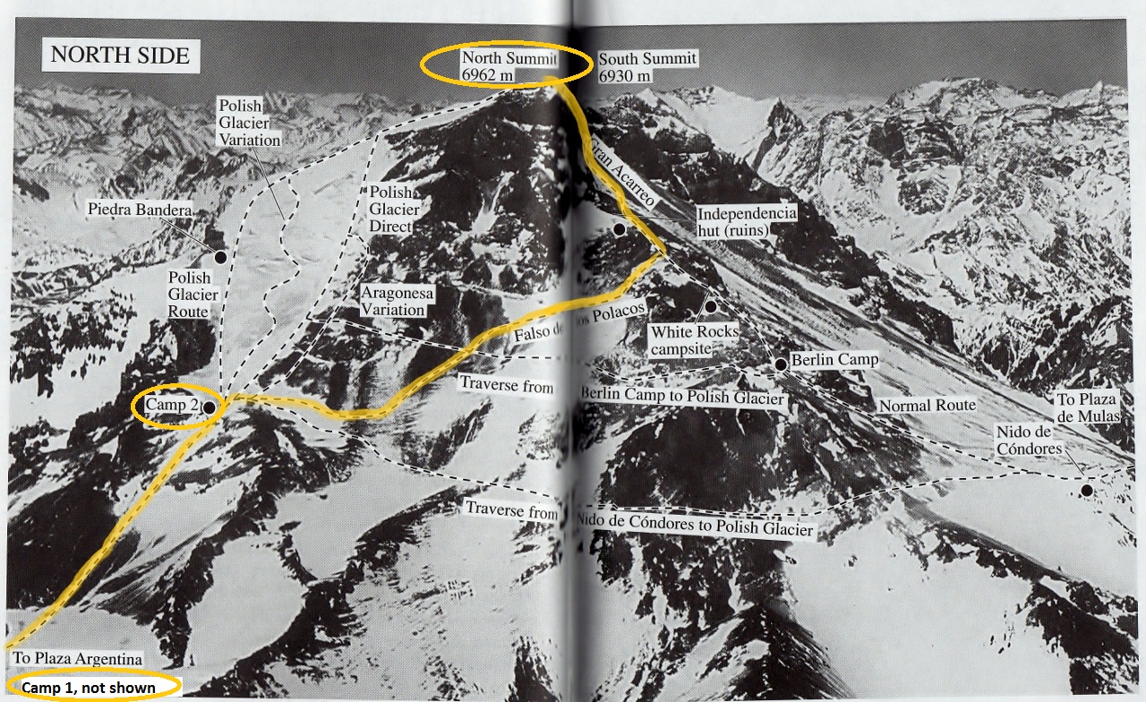
From Plaza Argentina they
will go to Camp 1, Camp 2, and then cross the mountain via the Falso del los Polacos route (translates to False Polish),
to meet up with the Normal Route at approximately 20,670 ft (6300 m). They will then follow the Normal Route
to summit (hyperlink to summit weather). They chose this route so they weren't on the crowded Normal Route the entire time
or the more technical Polish Direct route. In their research they found that many who intended to summit via the
Polish Direct, which is a bit more technical and requires particularly favorable weather conditions, end up summiting
via their planned route.
|
|