|
|
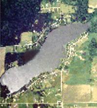
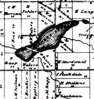
| Aerial View of Crockery Lake |
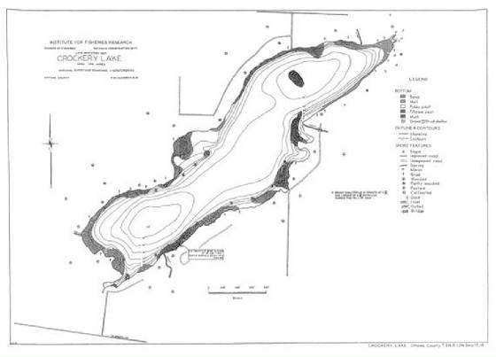
Crockery Lake occupies about 106 square acres
near the center of Chester Township in Sections 15 and 16. The lake has abundant Bluegills,
Large Mouth Bass, and Yellow Perch. Although recorded statistics list the maximum
depth as 54 feet, current residents, who scuba dive in the lake, claim there are spots where the lake is much deeper than
54 feet. The lake has an inlet and outlet.
It is also fed by many deep underground springs.
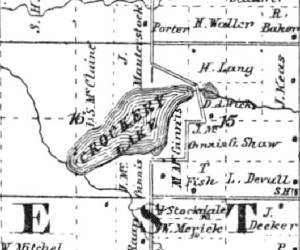
The 1839 survey map of the
township showed a Native American village of about 300 inhabitants living on the south side of the lake. No records have been found to indicate where the people of this village went after white settlement of
the township began in 1845.
Levi Devall, David Mauterstock,
John McGinnis, George Michael Miller, and Giles Shaw each purchased lakefront land from the State of Michigan in 1854. John Keas purchased lakefront land from the state in 1856 and again in 1865. John McGinnis purchase additional lakefront land from the state in 1865.
Henry C. Hilton also purchased lakefront land from the state in 1865. The
final lakefront land purchase from the state was made by Francis Vanderhoof in 1889.
The chart below lists the
names of the land purchasers, the description of the land purchased and the date of purchase.
|
Name |
Description |
Date
Purchased |
|
Devall, Levi |
Sec15 S1/2 SE1/4 |
Oct 12, 1854 |
|
Hilton, Henry C. |
Sec16 Government Lot #4 |
Nov 28, 1865 |
|
Keas, John |
Sec15 E1/2 NE1/4
Sec16 Government Lot #3 |
Apr 15, 1856
Feb 3, 1865 |
|
Mauterstock, David |
Sec16 NW1/4 NE1/4 |
Nov 9, 1854 |
|
McGinnis, John |
Sec15 Government Lot #3
Sec15 SW1/4 SW1/4
Sec16 Government Lot #1
Sec16 Government Lot #2
Sec16 Government Lot #6 |
Nov 9, 1854
Jan 26, 1865 |
|
Miller, George Michael |
Sec16 NW1/4 SW1/4 |
Oct 14, 1854 |
|
Shaw, Giles |
Sec15 N1/2 SE1/4 |
Oct 30, 1854 |
|
Vanderhoof, Francis |
Sec15 Government Lot #1 |
Jan
2, 1889 |
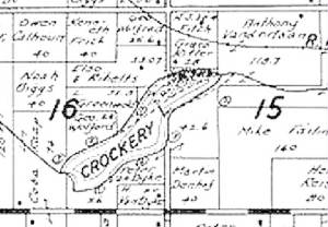
Early plat maps show no homes
located on the lake shore in 1864, one house on the north side and one house on the south side in 1876 and in 1897. In 1912, there were two houses on the north side and one house on the south side of the lake.
|
|
| 1864 Plat Map of Crockery Lake Area |
|
|
| 1876 Plat Map of Crockery Lake Area |
|
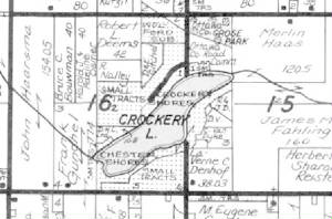
By 1948, small lake lots
were being sold on Crockery Lake and vacation cottages were being built. On September 11, 1948, Peter J. and Minnie VanDyke registered a plat, the Crockery Shores Subdivision, of part of their
land on the south lakeshore and began to sell lots. Eventually the VanDyke family
registered three additional plats. More cottages were built. By 1970, many of the cottages around the lake were being converted into permanent dwellings or demolished
and new year-round homes built in their place. Today, most of the lakeside houses
on Crockery
Lake
are year round residences. Only a few remain as vacation cottages. In addition to the lakeside homes, many houses have been built on the roads, opposite the lakeside, that
exist on the north and south sides of the lake.
|
| 1955 Plat Map of Crockery Lake Area |
|
|
| 1995 Plat Map of Crockery Lake Area |
|
|
| 2002 Crockery Lake Area |
|
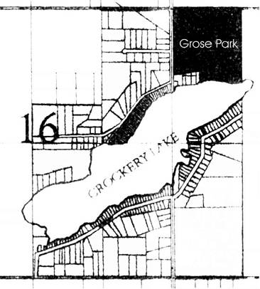
In 1963, the Ottawa County Road Commission purchased lakeside land on the northeast side of the lake. The Road Commission constructed a county park on the site. Named
Grose
Park,
it opened in 1964.
In 1975, the Chester Township Board passed a resolution to pay 1/3 of the cost of establishing a lake level and constructing a
dam in the outlet of Crockery Lake. This dam or weir was constructed the following year.
From Chester Township Records
Grose Park
|